
Whatever you're building, we're here to : capture document & deliver
PHOTOGRAMMETRY
-
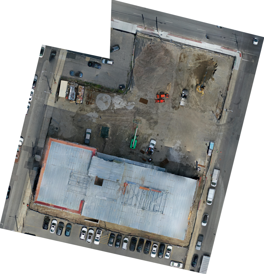
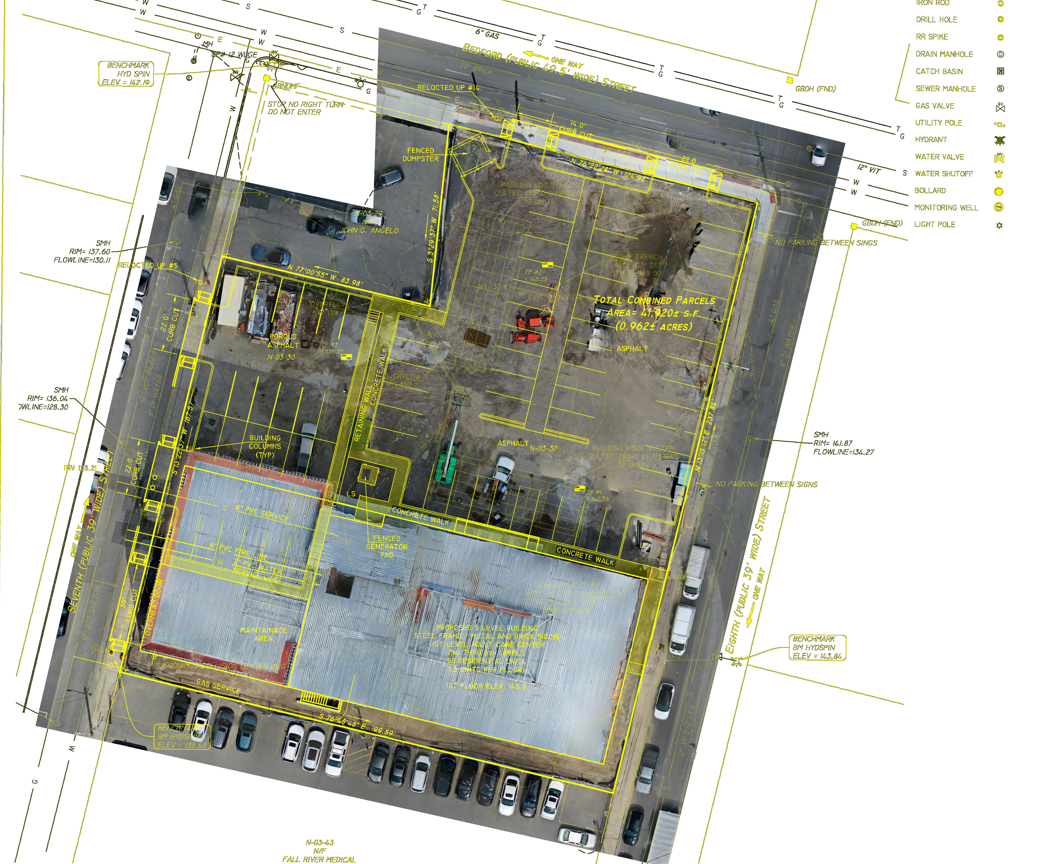
capture hundreds, sometimes thousands, of high-resolution aerial photographs across the entire construction site. These images are then processed and stitched together to create a highly accurate, large-scale 2D orthomosaic map. By repeating this process on a weekly or bi-weekly basis, we generate a clear visual timeline of the project’s progress. We can also overlay your final site plans and grading drawings directly onto the current orthomosaic map, making it easy to visually compare the as-built conditions with the as-designed plans and quickly identify any deviations.
WHAT WE DO...
GROUND/INTERIOR
AERIAL
3D MAPPING
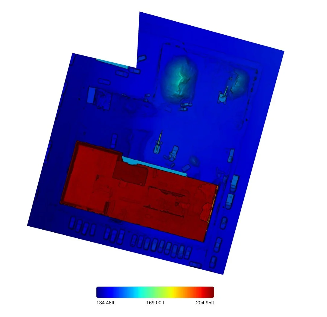
Like Photogrammetry, 3D Mapping uses drone photography and advanced processing to create accurate digital models of your job site.
Here’s how it delivers real results:
-
Weekly 3D models provide a clear visual timeline of construction.
Reduces reporting time by up to 75% compared to traditional methods.
-
Instantly compare as-built conditions against design plans.
Catches issues early, reducing rework costs by 20–40%.
-
Precise calculations for cut/fill, stockpiles, and material quantities.
Achieves ±1–3% accuracy, helping prevent costly over/under ordering.
-
Minimizes the need for personnel in hazardous areas.
Reduces on-site survey time from days to just hours. *Not to replace a licensed surveyor.*
-
Shareable 3D models and interactive tours keep owners, lenders, and teams aligned.
Improves decision-making speed and leads to faster draw approvals.
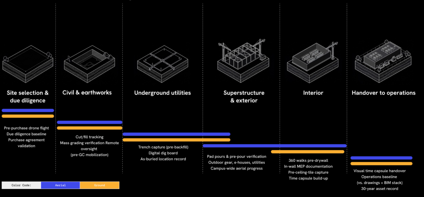
interior/exterior 360° walkthrus
-
View the entire site from anywhere anytime.
-
Quickly spot missing work, quality problems, or deviations from plans
-
Architects, engineers, and stakeholders can review and provide feedback faster
-
Compare scans over time to track real progress
-
Better communication leads to fewer mistakes and change orders
-
Build trust by giving them easy virtual access to their project
-
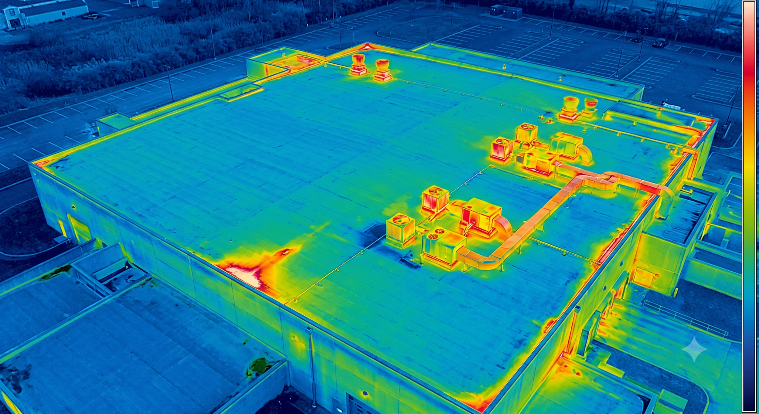
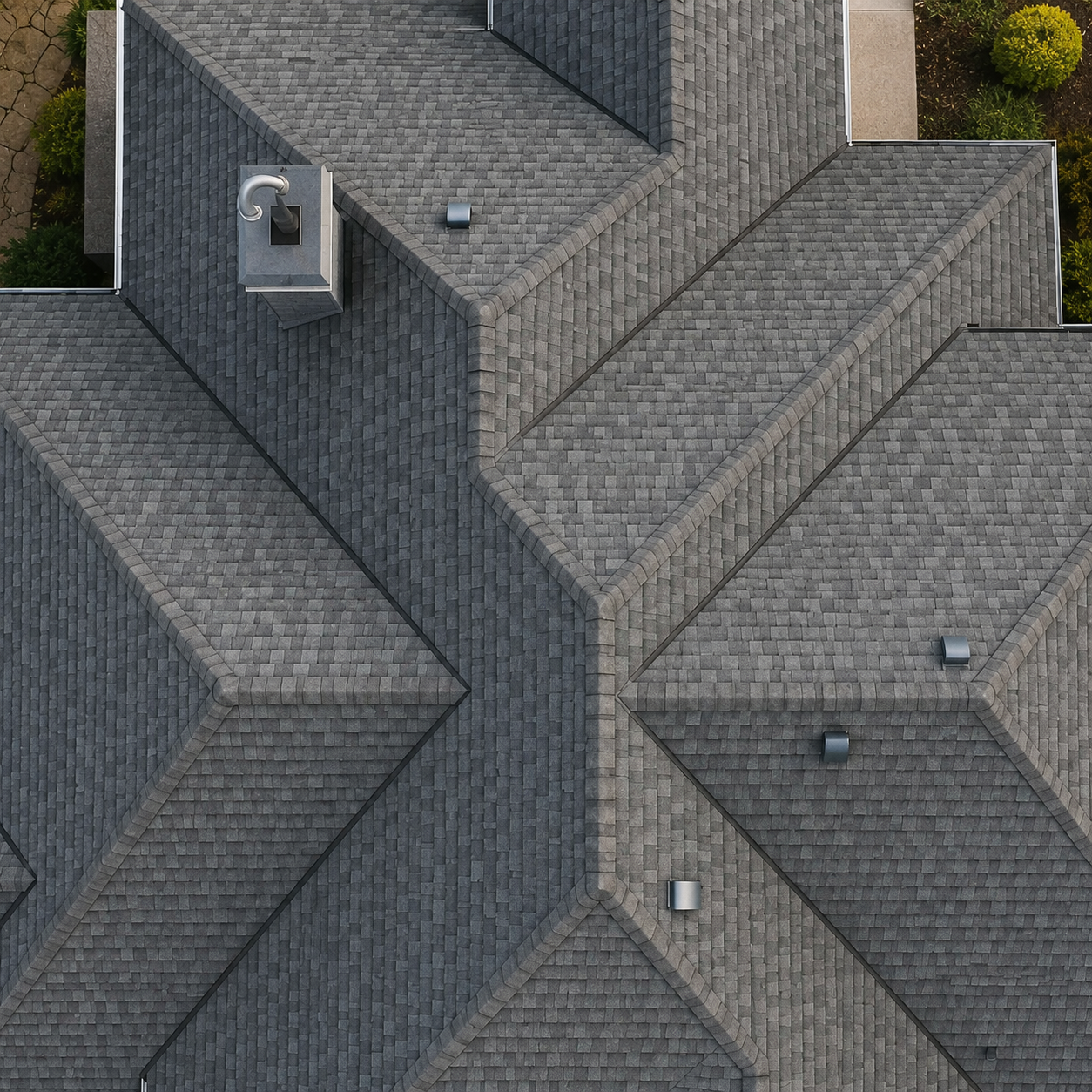
Drones provide a safer, faster, and more cost-effective alternative to traditional rooftop and facade inspections. Using high-resolution cameras, thermal imaging, and 4K video, drones can thoroughly inspect hard-to-reach areas without putting workers at risk.
-
residential & commercial real estate photos
Luxury videos for social media
360° tours using Matterport
-
Progression photos/videos of your site, whatever the project
Aerial & Ground videos/photos shot vertical or horizontal for Instagram/social media
-
Using a drone mounted thermal camera and DroneDeploy to process images, anomalies can be found during solar panel inspections.